

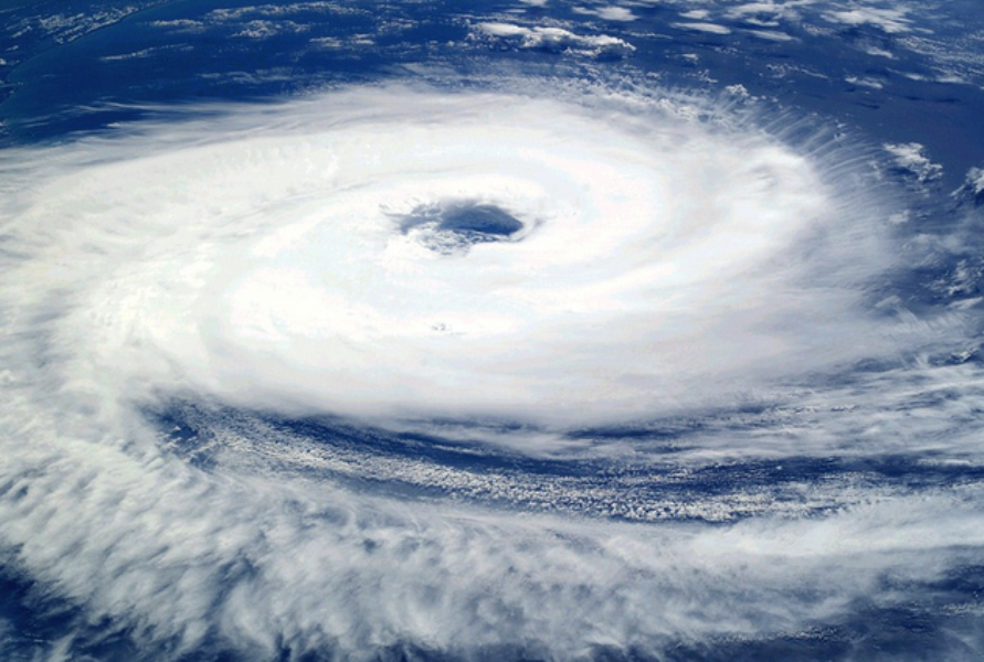
Samar – Der schwere tropische Sturm mit dem internationalen Namen Fung Wong ist am Freitagnachmittag in die Philippine Aera of Responsibility (PAR) gekommen und hat den nationalen Namen Uwan erhalten. – klajoo.com – STS Uwan intensivierte dich am Freitagabend zu einem Taifun.
Das Zentrum von Uwan befand sich am Samstag um 22:00 Uhr, 380 Kilometer Ost von Virac, Catanduanes.
Die Philippine Atmospheric, Geophysical and Astronomical Services Administration (PAGASA) hat am Samstag in seinem Taifun Update #6 um 23:00 Uhr, folgende Sturmsignale ausgegeben:
Sturmsignal 4
Luzon: Catanduanes.
Sturmsignal 3
Luzon: Aurora, the northern and eastern portions of Quezon (Pitogo, San Andres, Buenavista, San Francisco, Calauag, Infanta, Lopez, Catanauan, Mulanay, Guinayangan, Unisan, General Luna, Plaridel, Quezon, Alabat, Sampaloc, Macalelon, Mauban, General Nakar, Perez, Agdangan, Gumaca, Atimonan, Real, San Narciso, Tagkawayan) including Polillo Islands, Camarines Norte, Camarines Sur, Albay, and the northern and eastern portions of Sorsogon (City of Sorsogon, Barcelona, Bulusan, Pilar, Castilla, Gubat, Casiguran, Donsol, Prieto Diaz).
Visayas: The eastern portion of Northern Samar (Palapag, Mapanas, Laoang, Gamay, Catubig, Pambujan, Biri).
Sturmsignal 2
Luzon: Mainland Cagayan, Isabela, Quirino, Nueva Vizcaya, Apayao, Abra, Kalinga, Mountain Province, Ifugao Benguet, Ilocos Norte, Ilocos Sur, La Union, Pangasinan, Nueva Ecija, Bulacan, Tarlac, Pampanga, Zambales, Bataan, Metro Manila, Rizal, Laguna, the rest of Quezon, Cavite, Batangas, Marinduque, the northern portion of Oriental Mindoro (Puerto Galera, San Teodoro, Baco, City of Calapan, Naujan, Pola, Victoria), the northern portion of Romblon (Banton), the rest of Sorsogon, and Masbate including Ticao and Burias Islands.d.
Visayas: The rest of Northern Samar, the northern and central portions of Samar (Matuguinao, San Jose de Buan, Calbayog City, Tagapul-An, Santo Niño, Almagro, San Jorge, San Sebastian, Jiabong, Pagsanghan, City of Catbalogan, Gandara, Motiong, Santa Margarita, Tarangnan, Paranas, Hinabangan), the northern and central portions of Eastern Samar (Maslog, San Policarpo, Dolores, Jipapad, Oras, Arteche, Can-Avid, City of Borongan, Taft, Sulat, San Julian, Maydolong), and the northern portion of Biliran (Maripipi).
Sturmsignal 1
Luzon: Batanes, Babuyan Islands, the rest of Romblon, the rest of Oriental Mindoro, Occidental Mindoro, Calamian Islands, and Cuyo Islands.
Visayas: The rest of Samar, the rest of Eastern Samar, the rest of Biliran, Leyte, Southern Leyte, Bohol, the northern and central portions of Cebu (Medellin, Daanbantayan, City of Bogo, Tabogon, San Remigio, Tabuelan, Borbon, Sogod, Tuburan, Catmon, Carmen, Danao City, Compostela, Liloan, Consolacion, Lapu-Lapu City, Mandaue City, Cordova, Asturias, Cebu City, Balamban, City of Talisay, Toledo City, Minglanilla, Dumanjug, Argao, Sibonga, Barili, Ronda, Moalboal, Badian, Dalaguete, Alcantara, City of Carcar, City of Naga, San Fernando, Pinamungahan, Aloguinsan) including Bantayan and Camotes Islands, the northern and central portions of Negros Occidental (City of Escalante, Toboso, Sagay City, Cadiz City, Calatrava, Manapla, City of Victorias, Enrique B. Magalona, Silay City, City of Talisay, San Carlos City, Salvador Benedicto, Murcia, Bacolod City, Hinigaran, City of Himamaylan, Binalbagan, Isabela, Moises Padilla, La Castellana, Pontevedra, San Enrique, La Carlota City, Bago City, Valladolid, Pulupandan), the northern portion of Negros Oriental (Canlaon City, Jimalalud, La Libertad, Tayasan, Vallehermoso, City of Guihulngan), Guimaras, Iloilo, Capiz, Aklan, and Antique.
Mindanao: Dinagat Islands, Surigao del Norte, the northern portion of Agusan del Norte (Tubay, Santiago, Jabonga, Kitcharao), and the northern portion of Surigao del Sur (Carrascal, Cantilan, Madrid, Carmen, Lanuza, Cortes).
Laut Vorhersage zieht TY Uwan heute und am Sonntag in westnordwestlicher Richtung. Dem prognostizierten Kurs zufolge könnte das Zentrum des Auges von Uwan am Sonntagfrüh nahe an Catanduanes vorbeiziehen und am Sonntagabend oder Montagfrüh bei Aurora auf Land treffen. Darüber hinaus besteht eine zunehmende Wahrscheinlichkeit einer leichten Verlagerung des prognostizierten Kurses von Uwan nach Süden, was zu einem direkten Treffer – d. h. die Augenwand trifft das Gebiet, ohne auf Land zu treffen – oder einem Landfall über Catanduanes führen könnte.
Nach dem Landfall wird Uwan das gebirgige Gelände von Northern Luzons überqueren und am Montagvormittag den Golf von Lingayen oder die Küstengewässer von Pangasinan oder La Union erreichen.
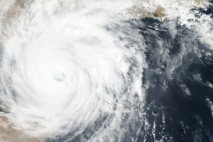
Uwan wird sich voraussichtlich rasch verstärken und könnte am Sonntag die Kategorie eines Supertaifuns erreichen, obwohl aufgrund günstiger Umweltbedingungen eine deutlich schnellere Verstärkung nicht ausgeschlossen ist. Es ist auch möglich, dass der Taifun mit oder nahe seiner maximalen Intensität auf Land trifft. Durch die Wechselwirkung mit dem Gelände wird sich Uwan deutlich abschwächen, es wird jedoch erwartet, dass er während seines gesamten Zuges über Northern Luzon als Taifun bestehen bleibt. – KR


Add Comment